Original Message
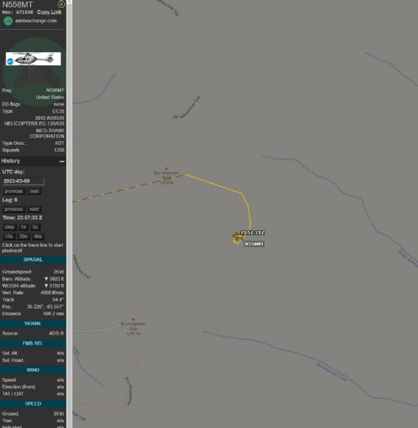
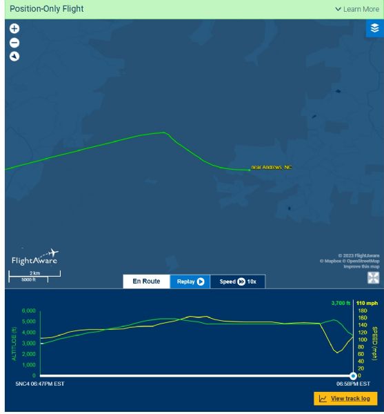
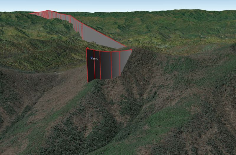
ADSB data shows after crossing the highest point in the flight path a pitch up and climb along with slowing down and a tight right hand 360. Data drops off but flight radar has more, pitches down and gains airspeed while losing altitude flowing the ridge line down for another 3 miles before landing in the first available area. Google earth overlay shows very little to no clearance on this ridge, there is also no sign of the landing gear in any of the photos at the scene. I hope I'm wrong but potentially clipped a ridgeline.